The AI workspace for spatial data
Leeana turns plain-language queries into maps, analysis, and ready-to-send reports
Add your data
Connect or upload your layers, or use built-in maps
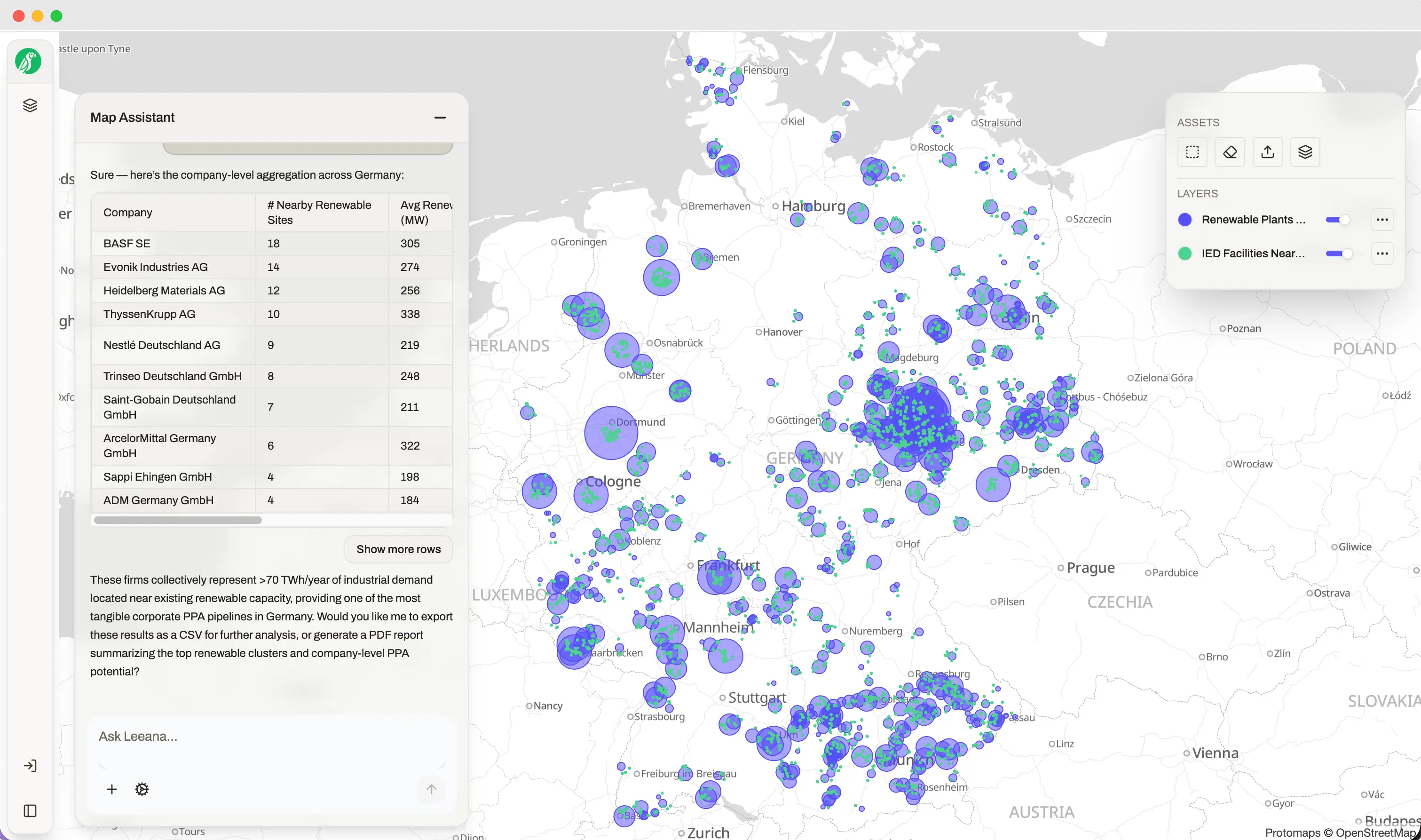
Talk to Your Maps
Ask questions in natural language and get instant, interactive responses
Export & Share
Generate maps, analysis, and professional reports to share with your team
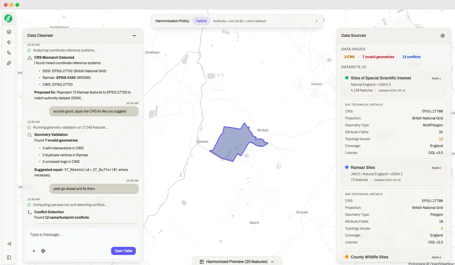
Upload your own maps & data
AI-assisted ETL that cleans, harmonizes, and validates your data - while you stay in control.
- Automated normalization:Formats, CRS, and attributes aligned in the background.
- Geometry repair & validation:Fixes self-intersections, unclosed rings, and duplicates.
- Human-in-the-loop, audit-ready:Conflicts flagged for review; every step logged and reproducible.
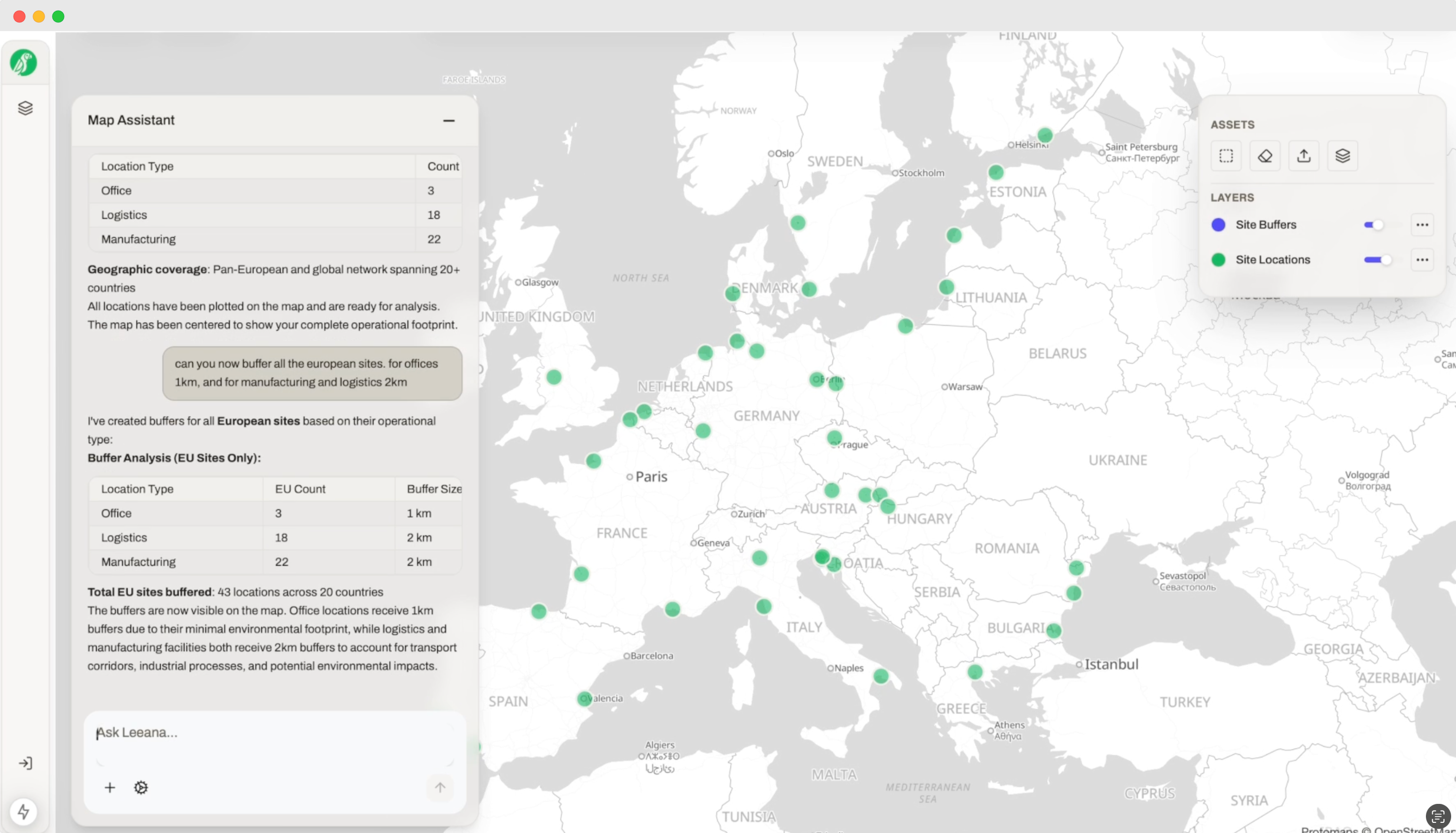
Explore, Analyze & Build
Turn datasets into living maps. Combine layers, ask questions in plain language, run repeatable playbooks, and collaborate in real time.
- Visualize, edit & style:Work on an interactive canvas. Draw and edit features, manage attributes, and apply consistent symbology.
- Enrich & combine datasets:Blend your layers with public or enterprise data. Join, overlay, buffer, clip, and dissolve - all audit-ready.
- Analyze with AI & playbooks:Ask in natural language, run spatial queries, and automate repeatable analyses with versioned playbooks.
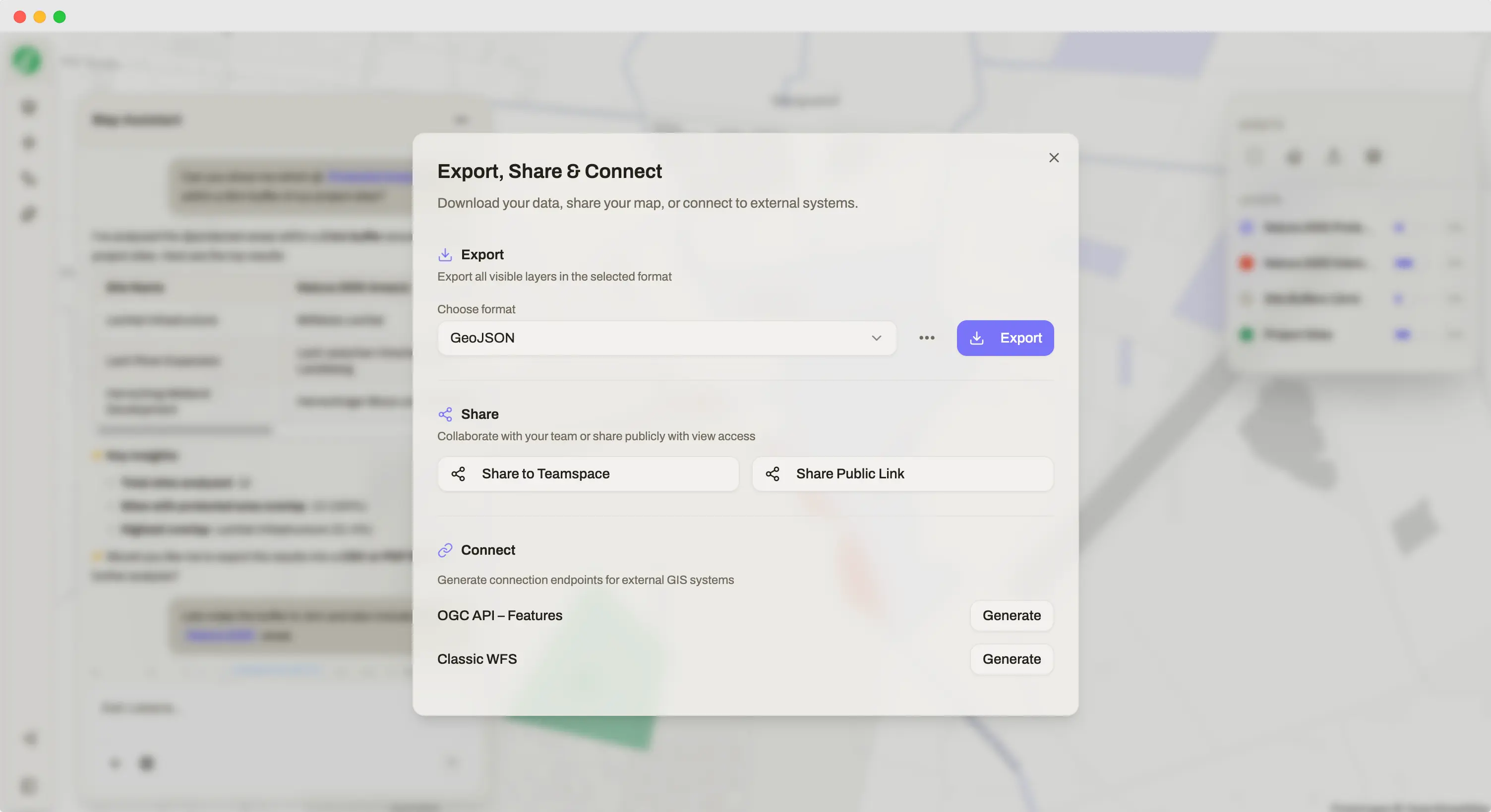
Export, Share & Connect
With one click, access multiple export and integration options. Download in your preferred format, share with your team, or connect directly to your systems.
- Download/Export:Choose from GeoPackage, GeoJSON, or Shapefile formats. Export your maps and data ready to use.
- Share with team:Share to your teamspace or make it public with a shareable link. Collaborate just like in Notion - with optional edit permissions.
- Connect to systems:Create direct links to OGC API - Features or Classic WFS endpoints. Integrate seamlessly with your existing infrastructure.
Data Catalogue
Access curated environmental datasets or bring your own - all organized, searchable, and audit-ready
Native curated datasets
An ever-growing, audit-ready catalog you can tag from chat and drop straight into workflows
Protected areas
Natura 2000, UNESCO, Ramsar, National databases
Land cover & land use
ESA WorldCover, Google Dynamic World
Energy
Node & zone prices, substations & power generation locations
Zoning
Zoning data & infrastructure layers
Manage your own datasets
Full control over the GIS layers you upload with intelligent organization and management tools
Organize layers
Group, tag, and search across your uploaded GIS datasets
Configure access
Set permissions and sharing controls for your team
Version control
Track changes and maintain dataset history
Auto-updates
Schedule refreshes for external data sources
From prompt to proof
Every result is deterministic and audit-ready. The AI guides, configures, and supports you while keeping full transparency.
Understands intent
Maps your prompt to the right workflows and datasets
Asks purposeful follow-ups
Clarifies buffer size, study area, or data source before running
Plans the sequence
Suggests the most efficient order of operations
Auto-configures parameters
Fills in tool settings for you - with full flexibility to adjust
Built for trust
Security, compliance, and transparency at the core - giving teams the confidence to rely on Leeana AI
Data Privacy
Your data stays yours. We never use customer data to train AI models.
Secure Infrastructure
EU-hosted, fully encrypted in transit and at rest, with strict tenant separation.
Audit & Compliance
Full audit trails and GDPR compliance built in, ensuring reproducibility and regulatory alignment.